
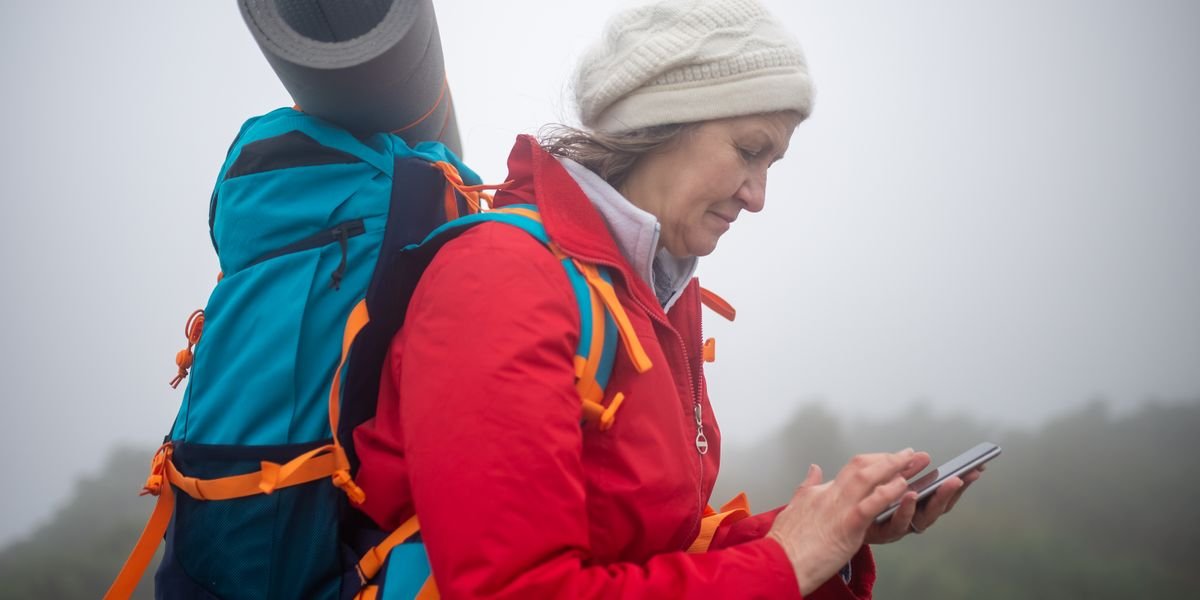
Photo by Kampus Production on Pexels
Best Backpacking Apps: Gaia GPS Wins for Offline Navigation, AllTrails for Free Trail Discovery, FarOut for Thru-Hikes
Gaia GPS is the best all-around backpacking app. It saves detailed topographic maps so you can use them offline. It also lets you plan routes before you lose signal. AllTrails is the best free pick for finding trails near you. FarOut is the best choice for long thru-hikes like the Continental Divide Trail.
Here is how the top picks compare:
| App | Best For | Price | Offline Maps |
|---|---|---|---|
| Gaia GPS | Offline navigation | Free / ~$40 per year | Yes |
| AllTrails | Trail discovery | Free / ~$36 per year | Yes (paid) |
| FarOut | Thru-hikes | Per-guide purchase | Yes |
All three work on iOS and Android. Most backpackers end up using more than one app. Each app covers a different part of the trip.
FarOut (formerly Guthook) is a backpacking app built for long thru-hikes like the Continental Divide Trail. Its guides list water sources, campsites, and town stops mile by mile, and you buy each trail guide separately. It is excellent for backpacking long trails, but for general offline navigation and trip planning, Gaia GPS or AllTrails are better all-around picks.
Quick Comparison: Best Backpacking Apps at a Glance
Gaia GPS is the best all-around backpacking app. It has offline topo maps and route planning. AllTrails is the best free option for finding trails. FarOut is the top pick for long thru-hikes.
| App | Best For | Price | Offline Maps | Key Features |
|---|---|---|---|---|
| Gaia GPS | Offline navigation | Free / ~$40 per year | Yes | Detailed topographic maps, route planning, points of interest |
| AllTrails | Trail discovery | Free / ~$36 per year | Yes (paid) | Trail reviews, photos, filters |
| FarOut | Thru-hikes | Per-guide purchase | Yes | Mile-by-mile guides, water sources, town info |
All three work on iOS and Android. Gaia GPS stands out for backcountry camping. Its USGS topographic maps work fully offline.
All three top picks — Gaia GPS, AllTrails, and FarOut — run on iOS, so iPhone users can choose based on need: Gaia GPS for offline navigation, AllTrails for free trail discovery, and FarOut for thru-hikes. The same is true for the other apps covered here, including CalTopo, onX Backcountry, Avenza, Hiking Project, Komoot, Cairn, and Windy.
Gaia GPS, AllTrails, and FarOut all work on Android as well as iOS, so Android users have the same top choices: Gaia GPS for offline navigation, AllTrails for free trail discovery, and FarOut for thru-hikes. The other apps mentioned in this guide, such as CalTopo, onX Backcountry, Avenza, Hiking Project, Komoot, Cairn, and Windy, also support Android.
What Is the Best Backpacking App for GPS Navigation and Offline Maps?
Gaia GPS is the best backpacking app for GPS navigation and offline maps because it saves detailed topographic maps to your phone before you lose signal. AllTrails is the best free pick for finding trails. FarOut wins for long thru-hikes.
Here is how the top navigation apps compare.
| App | Best For | Price | Offline Maps |
|---|---|---|---|
| Gaia GPS | Detailed topo maps, route planning | Free / ~$40 per year | Yes |
| AllTrails | Trail discovery, reviews | Free / ~$36 per year | Yes (paid) |
| CalTopo | Custom maps, slope shading | Free / ~$20 per year | Yes |
| FarOut | Thru-hikes | Per-guide purchase | Yes |
| onX Backcountry | Land boundaries, hunting | ~$30 per year | Yes |
| Avenza | Free PDF maps | Free | Yes |
Gaia GPS: Best for Detailed Topographic Maps and Route Planning
Gaia GPS leads for offline navigation because you can download USGS topographic maps and use them with no cell service. You can also plan routes and drop points of interest like water and campsites. In the gaia gps vs alltrails debate, Gaia GPS wins for detailed topo maps.
AllTrails: Best for Trail Discovery and Crowd-Sourced Reviews
AllTrails is the best free hiking app for most people. It has the largest trail database, with photos and reviews from other hikers. Offline maps need the paid plan.
CalTopo: Best for Custom Topo Maps and Slope Angle Shading
CalTopo lets you build your own maps and add slope angle shading, which shows how steep the ground is. That helps you judge avalanche risk and pick safer routes.
FarOut (Formerly Guthook): Best for Thru-Hikes with Water Sources and Campsites
FarOut is the top app for long trails like the Continental Divide Trail. Its guides list water sources, campsites, and town stops mile by mile. You buy each guide separately.
onX Backcountry: Best for Public Land Boundaries and Hunting Maps
onX Backcountry shows public land boundaries and property lines. That makes it the best pick for backpackers who hunt or camp near private land.
For a free option, Avenza lets you load PDF maps on iOS and Android. So if you want to know whether AllTrails or onX is better for backpacking, pick AllTrails for finding trails and onX for land boundaries.
How Do You Download Maps for Offline Use in Backpacking Apps?
Download your maps at home, on Wi-Fi, before you leave. Every app here saves maps for offline use, but each works a little differently, and some charge for it.
In Gaia GPS, open the area you plan to hike, tap the download icon, and pick a map layer like Gaia Topo or USGS topographic maps. You choose the size and zoom level. Gaia saves the map to your phone. Offline maps need a paid membership.
AllTrails works the same way. Find a trail, tap “Download,” and the map saves for offline use. That feature sits behind AllTrails Pro, not the free version.
FarOut is different. When you buy a trail guide, the whole guide downloads to your phone. No extra step, no extra fee.
Avenza is the simplest. Buy or grab a free PDF map, open it in Avenza, and it works offline right away. Both iOS and Android are supported across all four apps.
What Are the Best Apps for Trail Discovery and Trip Planning?
AllTrails is the best app for finding trails, thanks to its huge library of routes with reviews and photos. Hiking Project is the best free pick with offline maps. Komoot leads for route planning with turn-by-turn directions.
| App | Best For | Price |
|---|---|---|
| AllTrails | Finding trails with reviews and photos | Free; Pro ~$36/yr |
| Hiking Project | Free offline maps | Free |
| Komoot | Route planning, turn-by-turn nav | Free; region packs one-time |
| Wanderlog | Trip planning | Free |
| Google Earth | Scouting terrain before you go | Free |
AllTrails: Best for Finding Trails with Reviews and Photos
AllTrails wins trail discovery. Search any area and you get routes with distance, elevation gain, and recent user photos. Reviews tell you about mud, crowds, and water sources. It runs on iOS and Android.
Hiking Project: Best Free App with Offline Maps
Hiking Project is the best free hiking app for backpacking. It offers detailed topographic maps and offline downloads at no cost. The trail data comes from local groups, so coverage varies by region. Still, free offline maps are rare.
Komoot: Best for Route Planning and Turn-by-Turn Navigation
Komoot shines for komoot route planning. Draw a route on the map, and it snaps to real trails. It shows points of interest like water and campsites. Then it gives turn-by-turn voice cues as you hike.
For trip planning beyond the trail, Wanderlog is a solid wanderlog trip planner for organizing drives, stays, and permits in one place. Google Earth helps you scout terrain before you go.
What Safety Features Should You Look for in a Backpacking App?
Cairn is the best backpacking app for safety, thanks to automatic check-ins that alert your contacts if you run late. For pure emergency location, What3words is the fastest fix. Garmin Explore wins when you need satellite messaging beyond cell coverage.
Here is how the top safety picks compare.
| App | Best Safety Feature | Cost |
|---|---|---|
| Cairn | Location sharing and overdue alerts | Free tier |
| What3words | 3-word emergency coordinates | Free |
| Garmin Explore | Satellite messaging with inReach | Free app, inReach device required |
| AllTrails Lifeline | Live location sharing with contacts | AllTrails Pro |
Cairn: Best for Location Sharing and Overdue Alerts
Cairn shares your live location with chosen contacts. Set a check-in time, and if you miss it, Cairn emails them your last spot. It works on iOS and Android, and the free tier covers most hikers.
What3words: Best for Emergency Location Coordinates
What3words splits the world into 10-foot squares, each with three words. Tell a dispatcher your three words, and rescuers find you fast. It needs no signal to display them, only to send them.
Garmin Explore: Best for Satellite Communication with InReach
Garmin Explore pairs with an inReach device for two-way satellite texts. That means help works where cell coverage maps show nothing. You pay for the device and a plan, but it is the only true off-grid lifeline here.
Cell coverage maps in Gaia GPS and AllTrails help you plan where service dies. Download them before you go.
What Are the Best Educational Apps for Identifying Plants, Animals, and Stars?
Seek by iNaturalist is the best free app for identifying plants and animals on the trail. Point your camera at a leaf or a bird, and it names it on the spot.
| App | Best For | Price |
|---|---|---|
| Seek by iNaturalist | Plants and animals, live camera ID | Free |
| PictureThis | Plant ID with high accuracy | Free, $30/year |
| PeakFinder | Mountain identification | $5 |
| Star Walk 2 | Stars and planets | Free, $3 |
| SkyView Lite | Free star gazing | Free |
Seek by iNaturalist: Best for Plant and Animal Identification
Seek by iNaturalist works without a signal, which matters when you are miles from town. It runs on iOS and Android and needs no account.
The full iNaturalist app goes further. Your photos become real data that scientists use.
PictureThis: Best for Plant Identification with High Accuracy
PictureThis leads plant identification apps for accuracy. It spots diseases and care needs too, not just names.
The free version limits how many IDs you get per day. The paid tier costs about $30 a year.
PeakFinder: Best for Mountain Identification
The PeakFinder app labels every peak on the horizon. Pan your phone across a ridgeline, and names appear over each summit.
It works offline once you download a region. At around $5, it is one of the cheapest tools here.
For stars, Star Walk 2 and SkyView Lite both point out planets and constellations. SkyView Lite is free.
What Are the Best Weather Apps for Backpacking?
Windy is the best weather app for backpacking, thanks to its detailed wind, rain, and temperature forecasts on an easy map. For a free pick, the NOAA Weather app gives official US forecasts with no cost.
Windy shows you exactly where storms sit and how hard the wind will blow. That matters on exposed ridges. The windy weather app works on iOS and Android.
The noaa weather app is free and trusted, but it covers the US only. Check alltrails weather inside AllTrails for quick trail-level forecasts. Gaia GPS also has built-in weather layers, so you can view forecasts right on your topo map.
What Are the Best Trip Planning and Organization Apps for Backpackers?
Wanderlog is the best trip planning app for backpackers, thanks to its free Wanderlog itinerary builder that maps your route and tracks shared costs in one place. Packlight is the top pick for gear lists, since it builds pack checklists by trip type and weight. Google Drive handles shared documents, permits, and offline copies of your plans.
Wanderlog shines for group trips. You drop in stops, notes, and reservations, and it maps them in order. It also splits expenses, which pairs well with Splitwise for shared group costs.
Splitwise tracks who owes whom on gas, campsites, and food. It settles up at the end without awkward math.
Trail Wallet is the niche pick for long trips abroad. It logs spending in local currency and shows an atm fee saver, so bank fees don’t eat your budget.
All five apps run on iOS and Android and work alongside your maps for offline.
Wanderlog is the best trip planning app for backpackers, thanks to its free itinerary builder that maps your route and tracks shared costs in one place. For gear lists, Packlight is the top pick, and Google Drive handles shared documents, permits, and offline copies of your plans. For on-trail route planning, Gaia GPS and Komoot are the strongest options.
What Are the Best Social and Community Apps for Backpackers?
AllTrails is the best social app for most backpackers, because its trail reviews, photos, and condition reports come from millions of hikers. You can read a report from someone who walked the trail last week, not last year.
FarOut is the community pick for long trails. Its comments are the real feature: hikers post water levels, campsite conditions, and closures on the Continental Divide Trail and other thru-hikes, often within hours.
For finding people, Meetup is the top choice. Search “meetup hiking groups” and you’ll find local crews for day hikes and overnighters on iOS and Android. Couchsurfing helps too, connecting you with hosts near trail towns.
Facebook groups round out the list. Search your trail name plus “2026” and you’ll find thousands of hikers sharing shuttles, permits, and gear advice before you start.
Yes. Meetup is the top choice for finding backpacking buddies: search “meetup hiking groups” to find local crews for day hikes and overnighters on iOS and Android. Couchsurfing can also connect you with hosts near trail towns, and Facebook groups for your trail (search the trail name plus “2026”) are full of hikers sharing shuttles, permits, and gear advice before you start.
How to Build a Backpacking App Workflow: From Planning to Trail
Gaia GPS is the best app to anchor your backpacking workflow, and the winning setup pairs four apps: Gaia for navigation, FarOut for water sources, Windy for weather, and Cairn for safety.
Start with Gaia. Build your route, download maps for offline use, and mark points of interest like camps and water. This is your home base on trail.
Next, layer in FarOut. On long trails, its comments show water sources and campsites that Gaia’s topo lines can’t. Check it the night before each big climb.
Then add Windy. It shows wind speed, rain timing, and storm fronts better than most built-in weather tools. Look at it each morning before you pack up.
Cairn handles safety. It shares your location with people at home and sends an alert if you’re overdue. Set it up before you leave cell service.
The workflow is simple: plan in Gaia, check water in FarOut, watch weather in Windy, and let Cairn watch your back. Four apps, one system, from the couch to the summit.
How to Save Battery When Using Backpacking Apps
Your phone dies fast when apps run GPS all day, so the fix is simple: use airplane mode, dim the screen, and carry a power bank or solar charger backpacking setup for longer trips.
Airplane mode is the biggest win. It cuts the radio that hunts for signal in the backcountry, where there is none. Your offline maps still work fine.
Turn the screen brightness down to the lowest you can read. The screen eats more battery than GPS on most phones. Set your screen to lock after 30 seconds.
In Gaia GPS and AllTrails, switch GPS to low-power or battery-saver mode. You do not need pinpoint tracking every second. Check your location, then close the app.
A 10,000mAh power bank gives most phones two to three full charges. On trips over five days, a lightweight solar charger backpacking panel tops you up on sunny rest days. Keep it clipped to your pack and facing the sun.
What Are the Limitations of Backpacking Apps and How to Prepare for Them?
No backpacking app is fully reliable in the backcountry. GPS signals bounce off canyon walls and dense tree cover, so your blue dot can drift a quarter mile off trail. Apps also crash, freeze, or drain your battery at the worst moment.
Steep terrain makes it worse. In deep canyons, your phone may lose its GPS lock for hours. A downloaded map still shows the route, but your live position may not appear at all.
That is why every backpacker should carry a paper map and compass as a backup. Print the map for your route, or buy a waterproof version. Know how to read it before you leave home.
Charge your phone fully, pack a power bank, and download maps for offline use before you go. Treat your app as a helpful tool, not your only plan.
Frequently Asked Questions
Is AllTrails or onX better for backpacking?
AllTrails wins for most backpackers. It has a bigger trail database, millions of reviews, and works on iOS and Android.
onX Backcountry is better if you need public land boundaries. Hunters and dispersed campers pick it for that reason.
What is the best free hiking app for backpacking?
Hiking Project is the best free hiking app for backpacking. It offers offline maps and elevation profiles at no cost.
AllTrails also has a solid free tier. You can browse trails and read reviews without paying, but offline maps need AllTrails Pro.
What is the best app for backcountry camping?
Gaia GPS is the best app for backcountry camping. Its detailed topographic maps show campsites, water sources, and points of interest far from any trailhead.
For thru-hikes like the Continental Divide Trail, FarOut is the stronger pick. Its community comments flag campsites and water sources mile by mile.