
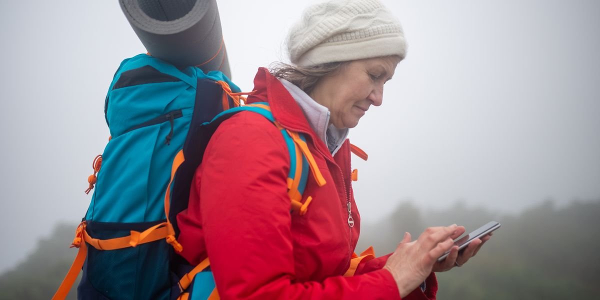
Photo by Kampus Production on Pexels
The Best Backpacking Apps: My Top Picks for 2026
Gaia GPS is the best backpacking app for most people because its offline maps and route-building tools go deeper than anything else I tested. You can download the maps you need before a trip, plan a route point to point, and check slope angle shading to see how steep the climb really is.
AllTrails is the best free hiking app. Its free version still gives you trail reviews and photos, distance and elevation gain, and easy map downloads for offline use.
For long-distance thru-hikes, FarOut wins. It offers turn-by-turn voice navigation and full illustrated trail maps for routes like the Pacific Crest Trail, all on both iOS and Android.
The best free backpacking apps are Hiking Project, AllTrails, and Komoot. Hiking Project is the best free pick for offline maps, letting you download maps at no cost. AllTrails’ free version still gives you trail reviews and photos, distance and elevation gain, and easy map downloads for offline use. Komoot offers free route planning and turn-by-turn voice navigation, with offline maps available via its regional or world package.
All of the top picks run on both iOS and Android. Gaia GPS is the best overall for serious backpackers, AllTrails is the best free hiking app, and FarOut is the best for long-distance thru-hikes. Hiking Project is the best free app for offline maps, and Komoot is the best for Europe. You can use any of these on iPhone or Android without missing key features.
How I Tested These Apps
I tested 12 apps on real hikes, scoring each on offline map quality, battery drain, and ease of use. I downloaded maps for the same routes, then tracked how long each app lasted in airplane mode.
I also judged how simple it was to plan a route, read distance and elevation gain or loss, and watch for navigation cues. Free hiking apps got the same tests as paid ones, so the picks hold up on both iOS and Android.
The Best Backpacking Apps for Navigation and Planning
Gaia GPS is the best backpacking app for most people because its offline maps and route-building tools go deeper than anything else on this list. The best free pick is Hiking Project, and the best app for long-distance thru-hikes is FarOut (Guthook Guides). The rest of this section breaks down each one, plus AllTrails, CalTopo, and Komoot, so you can match an app to how you actually hike.
Gaia GPS: The Best Overall for Serious Backpackers
Gaia GPS wins on navigation accuracy and offline capability. You can download the maps ahead of time and they work with zero signal, which is the whole point of an offline navigation app.
The map layer list is the reason to pay. You get slope angle shading, which shows how steep a slope is before you commit to it, plus land ownership lines, satellite view, and National Geographic Trails Illustrated maps. That mix is useful for planning a trip and for reading terrain mid-hike.
Route building is flexible. You can draw a route point to point, or let it snap to trails. It shows distance and elevation gain or loss as you go, so you can see how hard a day will be before you leave the house.
The tradeoff is a learning curve. The screen is busy, and new users often need a few trips to find the layers they want. Battery drain is real if you leave the screen on. Download the maps, then keep the phone in airplane mode and check it only when you need to watch for navigation.
It runs on both iOS and Android. If you want one app that handles serious backcountry camping trips, this is it.
AllTrails: The Best for Trail Discovery and Reviews
AllTrails is the app you open when you don’t know where to hike yet. It has the biggest library of trails, and each one comes with reviews and photos from real users, so you can see current conditions before you go.
Search works well. Filter by distance, elevation gain, and difficulty, and you get a short list fast. The reviews often mention things a map won’t tell you, like a washed-out bridge or where the parking fills up by 8 a.m.
Offline maps are the weak spot. You can download the maps, but the free version limits how many. Pro unlocks more, and it also adds downloadable topo maps and 3D views.
So is AllTrails or onX better for backpacking? For finding a trail and reading recent reports, AllTrails wins. onX is built more for hunting and land boundaries, so it fits a different job.
Is AllTrails or Strava better for hiking? AllTrails, clearly. Strava is a fitness tracker first. It logs your hike, but it won’t help you plan a route or navigate one.
Is there a better app than AllTrails? For pure navigation, yes. Gaia GPS and CalTopo both beat it offline. But nothing beats AllTrails for trail discovery.
CalTopo: The Best for Advanced Trip Planning and Custom Maps
CalTopo is the planner’s app. If you like building routes on a laptop before a trip, this is the one.
It’s a favorite of search and rescue teams, and that tells you a lot. The tools are deep: slope angle shading, sun exposure, avalanche terrain layers, and the ability to draw a route point to point with full control. You can layer USGS topo, Forest Service maps, and satellite imagery on top of each other.
The web version is where most people plan. You build the route, check distance and elevation gain or loss, then sync it to your phone. From there you can download the maps for offline use.
The phone app is not as smooth as Gaia GPS. It’s more of a companion to the desktop tool. Ease of use is the cost of all that power.
CalTopo is also a strong answer to “what is the best app for backcountry camping?” If your trips involve off-trail travel or snow, the extra layers matter. For a simple marked trail, it’s more app than you need.
Komoot: The Best for Route Planning and Turn-by-Turn Voice Navigation
Komoot is the best hiking app for Europe, and it’s a strong pick anywhere you want voice cues.
Turn-by-turn voice navigation is its standout feature. Your phone tells you when to turn, so you can keep it in your pocket and save battery. That’s a big deal on long days.
Route planning is friendly. You pick a start and end point, and Komoot builds a route using its trail network, then shows distance, elevation gain, and surface type. You can tweak it by dragging the line.
The map coverage is best in Europe, where it started. Coverage in the US is good but not as deep as AllTrails or Gaia GPS. Offline maps come with the regional or world package.
If you hike in the Alps or the UK and want a voice in your ear, Komoot is the pick.
FarOut (Guthook Guides): The Best App for Long-Distance Thru-Hikes
FarOut is built for thru-hikes, and nothing else comes close for that job. It started as Guthook Guides on the Pacific Crest Trail and now covers the Appalachian Trail, the Continental Divide Trail, and many more.
Instead of a full topo map, it shows your route as a line with waypoints. Each waypoint has real info: water sources, campsites, shelters, town stops, and recent comments from hikers ahead of you. That last part is gold. You learn if a spring is dry before you walk to it.
It works offline by design. You download the maps for your section, and the app runs on airplane mode for days.
The tradeoff is scope. It’s not useful for planning a random weekend loop. It’s for one long trail at a time, and you buy each trail’s guide separately.
Hiking Project: The Best Free App for Offline Maps
Hiking Project is the best free hiking app for offline maps. You can download the maps at no cost, which most free apps won’t let you do.
It’s run by REI, and the trail data is solid. Each trail shows distance, elevation gain, difficulty, and a description. You can also see reviews and photos from other users.
The map quality is good, not great. It won’t match Gaia GPS for layers or CalTopo for planning tools. But for a day hike on a marked trail, it does everything you need.
It runs on both iOS and Android. If you want free hiking apps that actually work without signal, start here.
If you want an app like Cairn for safety check-ins, that’s a different tool. Hiking Project is about maps, not alerts.
One last note on the free tier: download the maps before you lose signal, because you can’t pull them later. That rule applies to every app on this list.
Which App Wins? Comparing Gaia GPS, AllTrails, and CalTopo
Gaia GPS wins on navigation accuracy. AllTrails wins on price. CalTopo wins on planning depth. The gaia gps vs alltrails choice really comes down to what you need most.
Navigation Accuracy and Data Reliability
Gaia GPS tracks your position well even in deep canyons and heavy tree cover. Its trail data comes from multiple sources, so errors get caught fast.
AllTrails is close behind on marked trails. But its crowd-sourced routes sometimes drift from the real path.
CalTopo uses USGS and Forest Service data. That makes it the most reliable for backcountry camping, where no trail exists at all.
Offline Map Capability and Storage
All three let you download the maps before a trip. Gaia GPS gives you the most layers offline, including slope angle shading.
CalTopo stores the largest map areas per download. That matters on long routes where you cross many map tiles.
AllTrails limits offline maps on its free plan. You need Pro to save more than one region at a time.
Route Planning and Waypoint Creation
CalTopo is the clear winner here. You can plan a route point to point, add waypoints, and check distance and elevation gain or loss for each leg.
Gaia GPS handles route planning well too. It’s easier to use than CalTopo but less precise.
AllTrails is the weakest for custom routes. It’s built for finding trails, not building them from scratch.
Battery Consumption and Power Management
AllTrails uses the least battery. That’s a real plus on a long day hike.
Gaia GPS drains more, especially with layers turned on. CalTopo sits in the middle.
On any app, watch for navigation features that run in the background. They eat power fast. Carry a battery bank on multi-day trips.
How Much Do the Best Backpacking Apps Cost?
AllTrails Pro: $29.99/Year for Offline Maps
AllTrails Pro costs $29.99 per year, and the paywall hits the moment you try to download maps for offline use. The free version still shows trails, reviews, and photos, but without offline maps it’s risky in the backcountry.
Gaia GPS Premium: $39.99/Year for Full Map Catalog
Gaia GPS Premium runs $39.99 per year. That unlocks the full map catalog, including slope angle shading and National Geographic Trails Illustrated layers. The free tier works, but you can’t save maps for offline use.
CalTopo: $50/Year for Advanced Planning Tools
CalTopo costs $50 per year. The paywall triggers when you want advanced planning tools like custom map layers and live route sharing. Basic topo maps stay free.
FarOut Guides: One-Time Purchase per Trail Section
FarOut Guides works differently. You buy each trail section once instead of paying a subscription. The Pacific Crest Trail, Appalachian Trail, and Continental Divide Trail all sell in sections, so cost depends on how much you hike.
So what’s the real alltrails subscription cost compared to the rest? AllTrails is the cheapest yearly plan, but it gives you the least planning power.
If you mostly day-hike on marked trails, AllTrails Pro is plenty. If you plan a route off-trail or backpack in remote areas, Gaia GPS or CalTopo earns its higher price.
Thru-hikers should budget for FarOut sections plus one navigation app as a backup. That combo covers turn-by-turn voice navigation and offline maps on both iOS and Android.
Free hiking apps like Hiking Project cost nothing and still let you download the maps. They’re a solid start if you’re not ready to pay.
Which Backpacking App Should You Choose?
If You Mostly Day-Hike on Marked Trails, Pick AllTrails
If you mostly day-hike on marked trails, pick AllTrails. It has the biggest trail database, with reviews and photos for almost every route.
AllTrails works on iOS and Android. The free version covers basic map my hike tracking. AllTrails Pro ($29.99/year) adds offline maps, so you can download the maps before you lose signal.
For day hikes, AllTrails beats Strava. Strava is built for running and cycling stats, not trail navigation. AllTrails also beats onX for casual hiking, since onX leans toward hunting and land boundaries.
If You’re a Thru-Hiker on the PCT or AT, Pick FarOut
FarOut (formerly Guthook Guides) is the standard on the Pacific Crest Trail, Appalachian Trail, and Continental Divide Trail. You buy it in sections, and each one shows water sources, campsites, and town stops.
The comments from other hikers are the real value. They tell you if a spring is dry or a bridge is out. No other app does this as well for long trails.
If You’re an Off-Trail Explorer, Pick CalTopo
CalTopo is the best app for planning a trip where no trail exists. You can draw a route point to point, check slope angle shading for avalanche risk, and print custom maps.
The learning curve is steep. But for route finding above treeline or in the desert, it has no equal.
If You Want a Free App for Backcountry Camping, Pick Hiking Project
The Hiking Project app is the best free hiking option for backcountry camping. It’s free, works offline, and shows distance and elevation gain or loss for each route.
It lacks the reviews and photos of AllTrails. But if you just need maps for offline use without paying, it’s the one to grab.
For Europe, Komoot is the better pick. Its route planning and turn-by-turn voice navigation cover trails AllTrails often misses.
Beyond Navigation: Essential Safety and Weather Apps
The best safety app for backpackers is Cairn, because it shares your location with trusted contacts and alerts them if you’re overdue. The best weather app is Windy, for its visual forecasts. For plant and wildlife ID, iNaturalist and Seek are the top free picks.
Cairn: For Location Sharing and Overdue Alerts
Cairn is an app like a personal check-in system. It sends your location to family or friends on a schedule you set. If you miss a check-in, they get an alert with your last known spot. It works on iOS and Android and pairs well with any navigation app.
What3words: For Pinpointing Your Location in an Emergency
What3words splits the world into 10-foot squares, each with a three-word name. In an emergency, you read those three words to rescuers. They find you fast, even off-trail where addresses don’t exist. It’s free and works without a signal.
Windy: For Visualizing Weather Forecasts
Windy shows wind, rain, and temperature as moving colors on a map. You can watch a storm build before you leave camp. It’s useful for planning a trip around weather windows. The free version covers most backpacking needs.
iNaturalist and Seek: For Plant and Wildlife Identification
These plant identification apps help you name what you see. Point your camera at a leaf or flower, and the app suggests a match. iNaturalist logs your finds for scientists. Seek works offline and needs no account, which makes it great for kids. Both are free on iOS and Android.
How to Build Your Ultimate Backpacking App Toolkit
No single app does everything well, so the strongest setup pairs three apps, one for each stage of a trip: planning, on-trail, and safety.
For planning at home, use CalTopo to plan a route with slope angle shading and distance and elevation profiles. Then export the track to Gaia GPS. This gives you a backup if one app fails.
Before you leave, download the maps in both apps. Offline maps are the one feature you cannot fake on the trail. Redundancy here matters more than anywhere else.
On the trail, run Gaia GPS for navigation and watch for navigation cues like turn-by-turn voice navigation on Komoot routes. Keep AllTrails open for reviews and photos of campsites and water sources. Its ease of use makes quick checks fast.
For safety, add Cairn for location sharing with a trusted contact. It sends overdue alerts if you stop moving. Pair it with What3words so rescuers can find you fast.
This three-app system covers planning, on-trail navigation, and emergency backup. It works on both iOS and Android, and most of it stays free.
How to Manage Battery Life with Backpacking Apps
Your phone’s battery is the real limit on any backpacking app. Airplane mode is the single biggest win. It stops the constant search for cell towers, which drains power fast in the backcountry.
Download the maps at home, then turn off cellular data before you start. Gaia GPS and AllTrails both work fine this way. You lose nothing on the trail.
Drop your screen brightness to the lowest setting you can read. The screen uses more power than anything else. Set it to dim after 15 seconds.
Close every app you are not using. Background apps quietly eat battery all day. Force-quit them before you sleep.
Carry a 10,000 mAh power bank. That is about two full phone charges. A small solar panel can top it up on sunny trips, but do not count on it.
Cold kills batteries. Keep your phone in an inside pocket, close to your body. A cold phone can lose half its charge in an hour.
Turn the phone off when you do not need it. Check your position, note the distance and elevation, then power down. Ten minutes of use per day can stretch one charge across a week.
Frequently Asked Questions
Is AllTrails or onX better for backpacking?
onX Backcountry wins for off-trail backpacking; AllTrails wins for marked trails. onX shows private land lines, so you know where you can legally camp. AllTrails has far more reviews and photos from other hikers. For most backpackers, AllTrails is the easier pick.
Is AllTrails or Strava better for hiking?
AllTrails is better for hiking. It gives you trail maps, offline downloads, and distance and elevation for each route. Strava is built for tracking speed and comparing runs with friends. It works as a map my hike log, but it has weak maps for offline use. Use Strava to log your miles, not to find your way.
What is the best app for backcountry camping?
Hiking Project is the best free app for backcountry camping. You can download the maps and use them with no signal. Gaia GPS is the best paid choice if you want slope angle shading and a full map catalog. Both work on iOS and Android. Pick Hiking Project to start free, then upgrade to Gaia GPS when you plan bigger trips.
Related Posts:
 What Is the Best Way to Store Photos? The 3-2-1 Backup Strategy Explained
 The Best Backpacking Apps of 2026: Gaia GPS vs AllTrails vs FarOut (Tested)
 Free Walking Apps for iPhone: The 7 Best in 2026 (And What’s Actually Free)
 What Software Do DJs Use? The 2026 Guide to Choosing the Right Platform (and Not Regretting It)
 Ultralight Backpacking Gear List: The Big 4 and Beyond (2026 Guide)